



Places25 Aug 20268 MIN

A Sahyadris trail that even Google Maps couldn’t figure

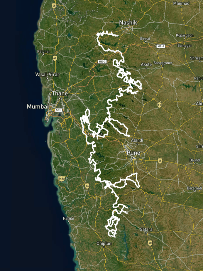
The Epic Sahyadri Trail maps 2,033 kms into 40 navigable routes for every kind of trekker—from the weekend hobbyist to one skilled enough to navigate the treacherous ghatvaat

Sahyadri Trail

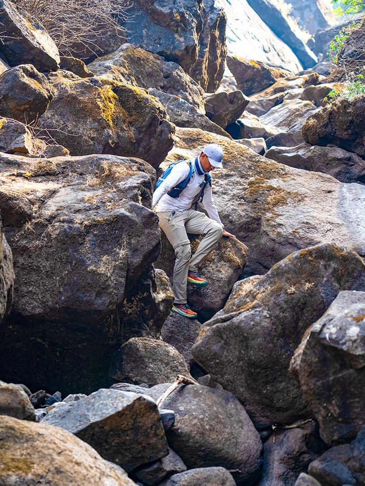
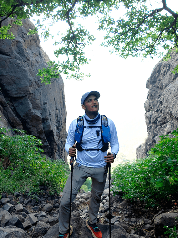
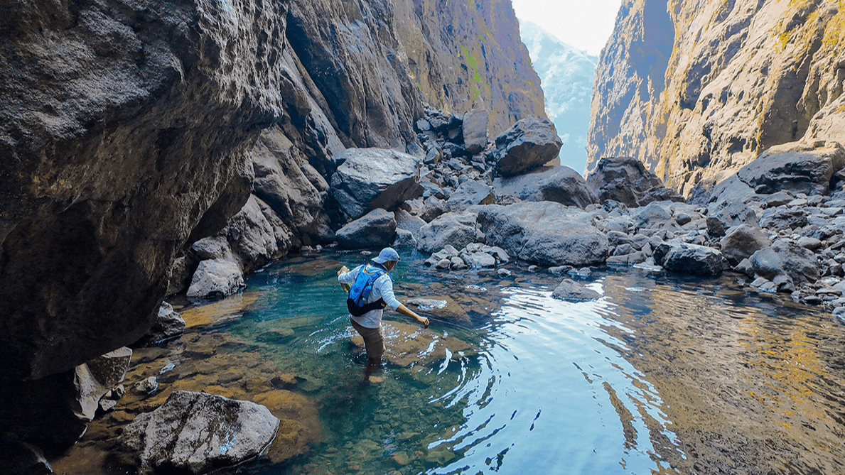
Shekhawat crossing the gorge of Sandhan valley

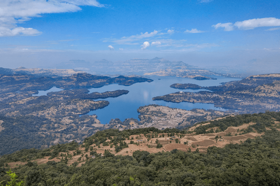
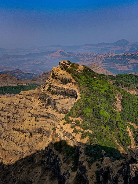
Quick, name something Google can’t do. I’ll go first: map the Sahyadri trails, camouflaged under thick canopies, in India’s Western Ghats. Even the search engine giant cannot get its roving satellites to comprehend the scale of the mountain chain, which extends between the northward Tapti River and the southward Cape Comorin. To put it simply, if a tree falls in the Sahyadris—a mountain range older than the Himalayas—there’s mostly no one around to hear it. But that kind of fear mongering has survived thus far only because the region has remained largely unmapped. That is, up until four months ago.

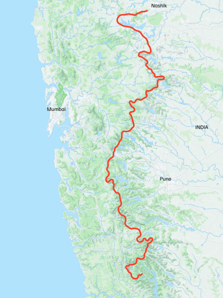
Jaipur-based Manav Shekhawat mapped the entire trail, section-wise, as part of the Epic Sahyadri Trail (EST) project. Starting in January, he completed a full scout of the 2,033-kilometre stretch in just 70 days. The 34-year-old trekker broke down the route into hundreds of day hikes, categorised the entire trail into 11 sections containing 40 stages. Stage 1 begins in north Vaitarna, leading to Bhandardara, Naneghat, Matheran, and more in the eventual stages. Everything is clearly mapped out on their Hikex website. Unlike most trails, these aren’t categorised on the basis of difficulty levels. Shekhawat believes each person’s experience is contextual, often dependent on hazards, skills, and season. As their website states: “One hiker’s easy is another’s accident.” 

Even so, the type of terrain, hazards, and skills required are spelled out for every leg of a route for assured clarity. There are also details on entry and exit points, hyper-localised intel on bus routes, side trails, footnotes with tips (like when not to carry “dead water” as the next village is not far away), points to watch out for (like the Vaitarna backwater crossing between Karol and Murbatwadi), and more such gems.

Every bit of information is spoon-fed, as if coming from a concerned friend on the lookout who’s letting you know where the Dhangars are grazing, which fort trails you can embark on, the wells you can make a quick pitstop at, and which villages enroute you can stay overnight.

The aim? Make the Sahyadris accessible for trekkers in a way like never before. Blame it on social media or corporate-led ennui, but adventure culture is having its moment, and Shekhawat’s aim is to make the outdoor experience as inclusive as possible, because “there is enough outdoors for every person’s fitness level”. The Sahyadris remain that evergreen pocket that could be a trekker’s dream. “It’s as much for weekenders looking for mere recreation as it is for seasoned trekkers who love to tread the unexplored paths.”

Take the ghatvaat, a labyrinth of rocky paths on the Sahyadri trail that the internet is yet to discover. “The whole landscape is such that first you have the Konkan, a flatland of around 40 to 60 kilometres, which is adjacent to the seashore. Basically, the peninsula of India. Then, the mountain range rises, and it stays like that for the remaining part. It is called Desh.” This is approximately nine-tenths of the vast stretch of plateau land to the east of the Sahyadri, which includes Harishchandragad, Bhimashankar, and Mahabaleshwar. The height of this plateau in its western portion is 600 metres above sea level, and in its eastern border area it is nearly 300 metres above sea level. Connecting the two geographically distinct Konkan and Desh, which are positioned almost like a ground floor and first floor, are a bunch of small gullies, or, as the locals say, ghatvaat. In Marathi, ‘ghat’ is a route with switchbacks and hairpin turns, and ‘vaat’ means ‘rasta’, or road.

Unforgiving by nature, these are the most demanding and challenging trails in the Sahyadris; take the word of the man who has trekked over 3,500 kilometres here. But if you’re looking for an adrenaline rush, you’re in the right place. “Ghatvaat are the most adventurous as well as the riskiest trails to do. Imagine a bold field, rocks the size of a room, spread over kilometres.” The trail itself is physically strenuous. “You’re either getting down or getting up.”

There is a way

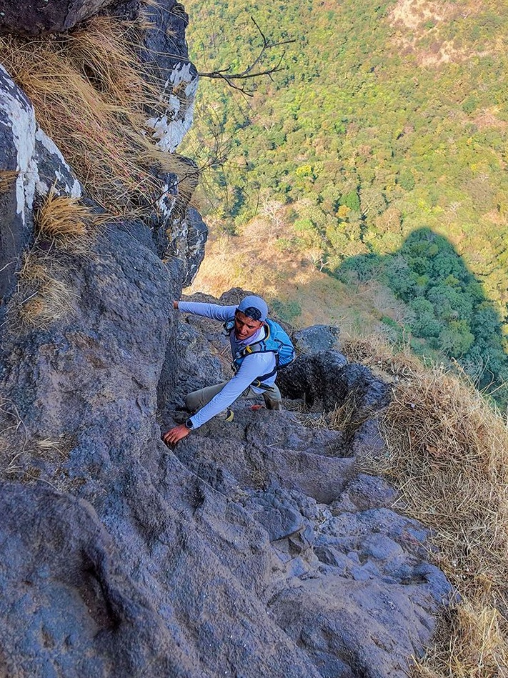
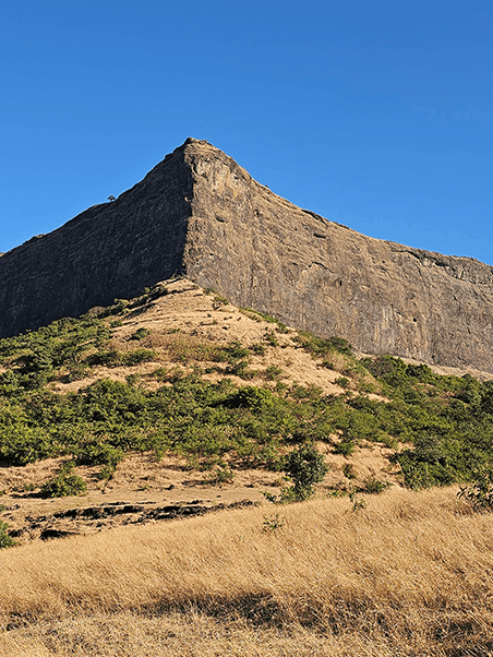
For Shekhawat, who has covered almost every ghatvaat, one stands out in particular—the Khutyachi wat, which comes in stage 17 of the mapped trail, between Ghatghar and Ahupe. Thankfully, rock-cut steps here carve a rough route. The catch? An 80-degree facade that you’re climbing up while the overhead sights play tricks on the eyes. “If you look at the mountain from a distance and I tell you there’s a trail and you can actually go there, you’ll say it is not possible. Because it looks like a sheer big sheet of rock! But there is a trail that ends at Rampur village.” Manav: 1. Google: 0.

Then, come the untraversed trails. “There are hundreds of such trails, of different degrees, in the region. If the ghatvaat are very well-used, you see a nice path. If they are not used, you have to do a little bushwhacking, and it’s not very pleasant.”

When to (not) go

Approach your ghatvaat trek as a calculated risk instead of a reckless one, with adequate prep in place. “First of all, do not explore the ghatvaat in monsoons, because there are chances of rock falls and flash floods. This should be done post-monsoon. Secondly, you have to really prepare yourself at a physical level.”

That’s where a platform like HikeX comes in. Led by Shekhawat and co-founder Shubrank Mukhiya, it is an Indian outdoor education and trail-mapping platform designed to promote safe, independent, and responsible hiking. Drawing from thorough fieldwork and hardcore first-hand experience, the HikeX website maps trails, builds outdoor education, and creates the infrastructure for safer, more sustainable hiking in India. It’s your go-to for all things trekking in India, complete with imagery, tricky routes, village pitstops, weather conditions, rest spots, spots with wells to draw water, trail pressure to avoid crowds, and more. As of now, the trails are available on the app, while paper maps are still underway.

HikeX stands for ‘hiking information knowledge experience’. We want to provide the latest credible information. We have an online paid community with over 300 members. Whenever somebody goes on a hike, they always have an option to get on a personal call with me,” shares Shekhawat.

Next, a plan is chalked out. “I help them improve their itinerary and suggest any improvements.” Based on the time a trekker has at hand, Shekhawat suggests the best possible trails. “I can suggest some physical exercises depending on whether that person wants to do it at home or has access to the gym.”

For Shekhawat, though, recommending trails that are truly enjoyable is non-negotiable: “Because it is important that they enjoy that experience so that they would want to do it over and over again. Hiking should not feel like an activity full of stress, especially for beginners. And we believe that the outdoors have to be as comfortable as the indoors. In the city, people are already stressed, and they want to just get back to nature, to feel relaxed. But imagine if they’re also struggling there. Then what’s the use?”

With trekking, of course, comes the opportunity to spot elusive wildlife. In terms of animal sightings in the Sahyadris, trekkers can expect to see one-week-old leopard cubs and barking deer. “They’re beautiful. The population of barking deer has increased over a couple of years, which means it is also a very healthy environment for prey to stay present.” There are also sloths, hyenas, and wild boar. Tigers roam reserved regions like Tadoba, which are not open to trekkers.

To dodge wildlife encounters, Shekawat shares a golden rule: make your presence felt and do not take any animal by surprise. They tend to attack in defence. It may go logically against what your instincts tell you to do, but “you should not hike in stealth. You can also carry a whistle if you think it’s very tense, and there are blind turns on the trail. Make your presence felt without creating noise pollution.”

Trekking etiquette 101

First things first, abide by the day and night divide. “A lot of carnivores are nocturnal, so please understand that the day is ours and the night is theirs. Try to finish your hike before sunset. We have created an SOS tool with a form regarding the trek you’re going to. If you do not come back on time, then we will inform the emergency contacts that there could be a potential search-and-rescue situation.”

Shekawat suggests speaking to locals who possess all the insider information that could potentially save lives. “They know it all, from what time the leopard comes to the village to its easy targets.” For instance, leopards would never attack humans but rather target cattle instead, focusing on sheep, goats and dogs or small puppies instead of bigger animals like buffaloes and cows.

Trekkers must also follow the “leave no trace” policy, which is exactly what it says. Do not throw trash, play loud music, or shout. “Try to go in smaller groups, of less than eight, if possible, and try to not subscribe to these bigger packages where you’ll see that 50 to 100 people are there on a trail. Reduce your ecological footprint.”

A beginner’s guide to trekking

Begin with a day trek: They’re a gentler introduction to the outdoors. Avoid a six-hour travel time for a two-hour hike.

Pack light: Carry a whistle, head torch, power bank, and lighter; keep your daypack light.

Know your SOS: Three long whistle blasts, a 3- to 5-second pause, then three more signals that someone needs help.

• Learn how to read a map.

Choose a trail close to home: Pick a mapped, beginner-friendly trek in your region—for instance, Matheran from Mumbai, Anjaneri Plateau from Nashik, K2S (Katraj to Sinhagad) from Pune, or Mahabaleshwar from south Maharashtra.

For scenic views: Try the Kalsubai-Harishchandragad region, where the landscape itself is a draw. Beginners can tackle Kalsubai as a day hike.

For fewer crowds: Explore Harishchandragad on weekdays, when its trails see fewer people. Bhimashankar gets extremely crowded on weekends.

Look beyond the forts: For quieter trails, head to the inner routes around Raireshwar, Koleshwar, and Mahabaleshwar. These plateau systems offer scenic day hikes, with homestays and hotels nearby.

Know your bailout: Understand the landscape and identify where you can exit or turn back if conditions worsen.

Know what to avoid: Some routes and features are unsafe in certain conditions—for instance, avoid the Durg Bhandar natural bridge on the Pahine-Taake Harsh trail during the monsoon.

Watch the weather: Monsoon whiteouts can obscure trails, while wet conditions make navigation difficult. Stay alert and stick to the route.

The Nod Newsletter

We're making your inbox interesting. Enter your email to get our best reads and exclusive insights from our editors delivered directly to you.